Along the Lutinelijn (1)
Where markers lose their function, space for imagination arises.


2025
Floor
DATE
This summer, Mister Motley and Into the Great Wide Open join forces once again by publishing the research of artists Sjoerd Willem Bosch and Sijas de Groot. They have spent several months on Vlieland for their new work Lutinelijn, which they will present within the art program of Into The Great Wide Open. This installation connects the maritime heritage of the sunken gold ship the Lutine (1799) with the landscape of Vlieland. Scattered across the island and the festival grounds, four objects and stories mark the historical navigation line. In their joint exploration of slowness, memory, and orientation, Sijas and Sjoerd investigate how the civil beacon that once marked the site of the Lutine can take on a new role in the Wadden area. In two contributions, they take the reader along in their process, through heritage, during walks, and a longing for the idea of coming home on an island. Today, part 1.
What if we don’t search for gold on the seabed, but within ourselves and among each other? What if the beacon helps us find that, without knowing exactly what we are looking for?
Lutinelijn – introduction
Along an invisible navigation line between the mudflat and the North Sea unfolds Lutinelijn – an art project by Sjoerd Willem Bosch and Sijas de Groot (Tussenland), developed for the art program of Into The Great Wide Open 2025. The installation connects the maritime heritage of the sunken gold ship “Lutine” (1799) with the physical and inner landscape of Vlieland. Spread across the island and the festival grounds, four objects and stories mark the historical navigation line.
In this joint exploration of slowness, memory, and orientation, Sijas and Sjoerd investigate how the civil beacon can take on a new role as an artistic object in the Wadden Sea region. In two contributions, they take the reader along in their process, through heritage, during walks, and a yearning for the idea of coming home on an island.
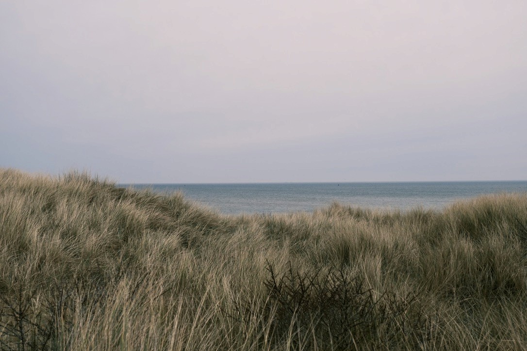
Photo: Sjoerd Willem Bosch and Sijas de Groot
Where the gold disappeared, a navigation line remains
Lutinelijn is inspired by an imaginary navigation line between two historical beacons on Vlieland: the Lutine Head and the Lutine Field Head. Together with two beacons on Terschelling – including the Brandaris – the beacons on Vlieland formed a navigation system: by maneuvering at sea so that the beacons on each island were precisely lined up in sight, one could determine the position of the sunken gold ship Lutine. The Lutine sank in 1799 off the coast of Vlieland, including the valuable cargo of gold and silver, destined for the reconstruction of the economy in Hamburg. The sunken cargo was important enough to mark the spot in the North Sea. Only a small portion was recovered, the rest presumably still lies beneath the sand of the Wadden Sea.
A collaboration on and from the place
From our shared fascination for structures at the edge of land and water, we shape a joint artistic investigation. On Vlieland, we meet with different backgrounds: Sijas as a theater maker, Sjoerd as an architect. The residency project Standplaats Vlieland offers us the space to follow the Lutinelijn in a series of short-term residencies. During these stays, we build a living archive — a growing collection of stories, themes, observations, and questions that arise along this imaginary line. We move between the everyday island rhythm, personal memories, and the cultural-historical layers of the island. The Lutine Head, rebuilt in 1999, although the marker has since worn away, serves as an important starting point. The local desire to re-establish this head fascinates us, precisely because its significance remains open. If the gold of the Lutine is untraceable, what does the Lutine Head still refer to? What value do we actually attach to this landscape?
Heritage, in our view, is more than just the preservation of the tangible; it emerges in the interaction between structure and story, between the civil and the artistic. Our collaboration allows us to navigate between the material and the immaterial, between physical structures and symbolic meanings. By walking, we explore how an old navigation line, the landscape, and the community are intertwined. Together with islanders, experts, and visitors, we gather stories, audio fragments, and reflections that reveal the changing relationship to place and memory.
A changing meaning for heads
The search along the Lutinelijn begins at the mainland in Harlingen, where Sijas’s grandfather once started a contracting company: H. De Groot & ZN, now known as De Boer and De Groot. The company built, among other things, beacons in the Wadden Sea: on Griend, the Richel, Engelsmanplaat, and Willemsduin on Schiermonnikoog. These objects spoke to Sijas' imagination – civil artworks as a symbol of the struggle against the water.
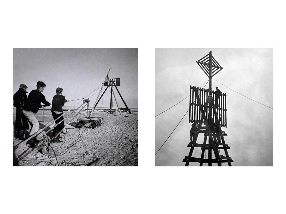
Heads are recognizable structures that were placed in the expansive Wadden Sea area in locations where clear landmarks, such as churches, were missing. The placement of the heads has long been a necessity for the trading towns in the Wadden area. Since the thirteenth century, barrels and heads have been used to indicate the correct shipping channels. Where a barrel is anchored to the sea bottom with a chain, heads can sometimes tower thirty meters above the landscape. In 1858, there were still 25 heads in the Dutch Wadden area; now there are only a handful [1]. With the advent of digital navigation techniques, heads lost their maritime function. When the original function disappears, a discussion begins about the heritage value. We wonder what beacons can mean beyond nautical tools. What if they can help us remember, orient, navigate in a changing world?
Sijas
“As an artist, I followed in the footsteps of my grandfather’s family business and began a quest for a new meaning of beacons – as carriers of stories. In the summer of 2024, I walked along the Frisian Wadden coast: a physical and symbolic pilgrimage in which I explored what connection means in times of change. I talked to residents about the pressures of tourism, the tension between preservation and development, and concerns about housing construction. Young people move away because of the lack of affordable housing, while more and more outsiders are buying houses. Villages are becoming decorations – attractive for visitors, but difficult to live in for the villagers who were born there. At the same time, hopeful voices also emerged: people living together in new ways, committed to their environment, and strengthening the bond with the landscape through heritage and stories. I ended my journey on Schiermonnikoog with Sjoerd, under the Willemsduin Head – to reflect on everything that had been set in motion.”
Lutine heads on Vlieland
After centuries of diving and dredging attempts, the search for gold has now been halted. What once was a prestigious gold hunt ended in the realization that the wreck and the cargo lie meters deep beneath the sand. In 1999, a new version of the Lutine Head was established during the so-called ‘Lutine year’, exactly two centuries after the shipwreck. It was more than a commemorative object. With commemorative coins, concrete gold bars, and the reconstruction of the head, a collective heritage story was brought to life. The marker of this new Lutine Head has been blown away by a severe storm and has now been lying in the dune for many years. Nevertheless, the desire to restore the Lutine Head lives on in Vlieland. A potential repurposing of this beacon immediately raises tensions. As soon as the subject comes up, different camps arise. Some want a contemporary interpretation: a new symbol that connects to the present and breaks free from nostalgia. Others long for an exact reconstruction, in line with how it once was — as if the physical form can retain the memory.

Photo: Sjoerd Willem Bosch and Sijas de Groot
To understand the significance of the Lutine for Vlieland, we read the book Lutine (2013) and dive into online archives. We immerse ourselves in a stubborn landscape with shipwrecks, drifting on the islands, and drowned villages. The numerous attempts to recover the Lutine gold have been documented multiple times. Journalists and tourists traveled with the divers. For instance, a reporter from De Telegraaf traveled with divers from Terschelling in the spring of 1933. Upon reaching the Lutine's location, he describes:
“The water is quite bearable, although sometimes a small wave breaks that makes our boat sway more strongly, but the visibility is very poor, so that Terschelling can still see Vlieland, let alone that one could use the cross-bearing, with which one can certainly position the Texel [the boat] exactly above the stern of the Lutine. Thus, three so-called “heads” are used on Terschelling and Vlieland. On the first-mentioned island, they are called the Brandaris, the Lutine Head, and the Noordvaarder; on Vlieland, the Zuidkaap, the Veldkaap, and the Lutine Head. They are all standing at mutual distances of 2 to 5 kilometers, and the whole was arranged with the help of a land surveyor. Now, to get to the right point, one must maneuver in such a way that each pair of heads of both islands is seen in one line.”[2]
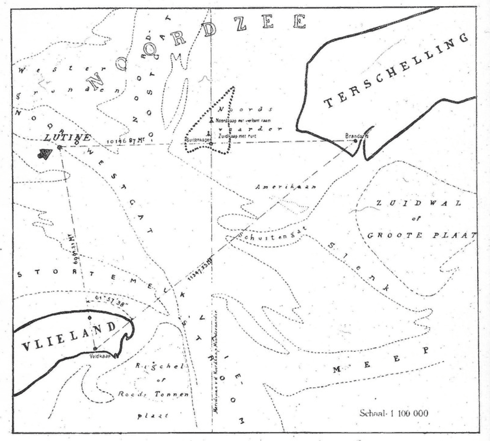
The location of the wreck of the Lutine, according to data from Taurel and Ter Meulen, map from 1886. Consulted via https://www.flickr.com/photos/130970247@N04/20268695231/in/dateposted/
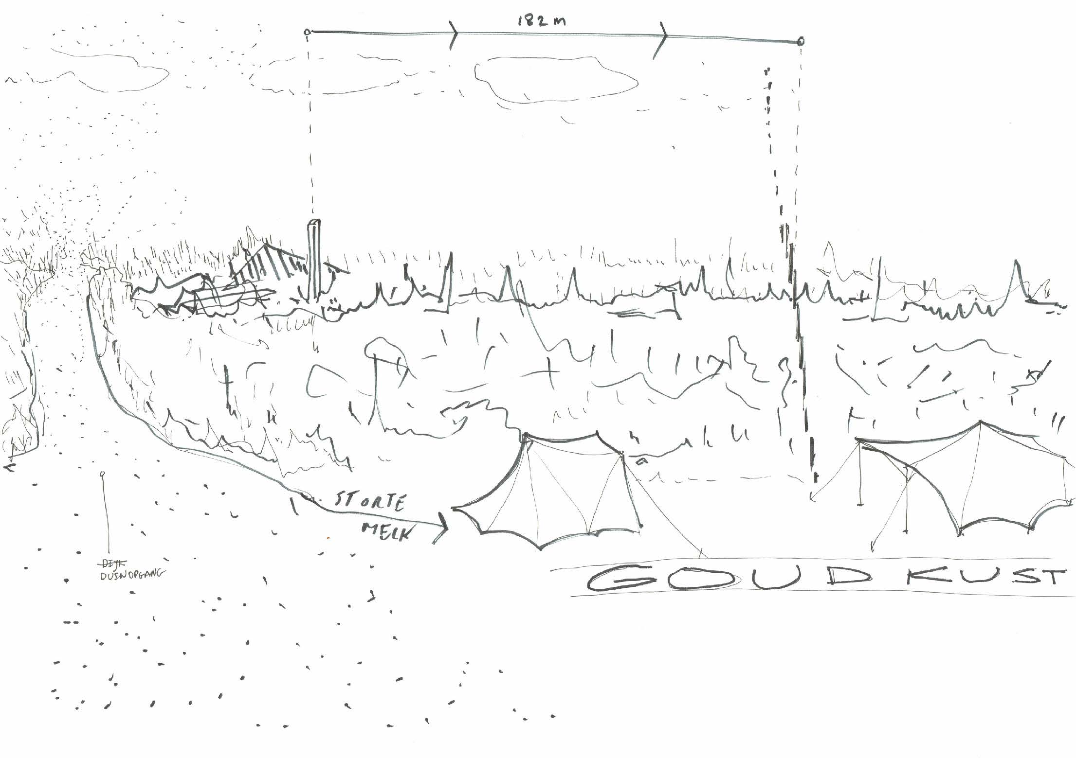
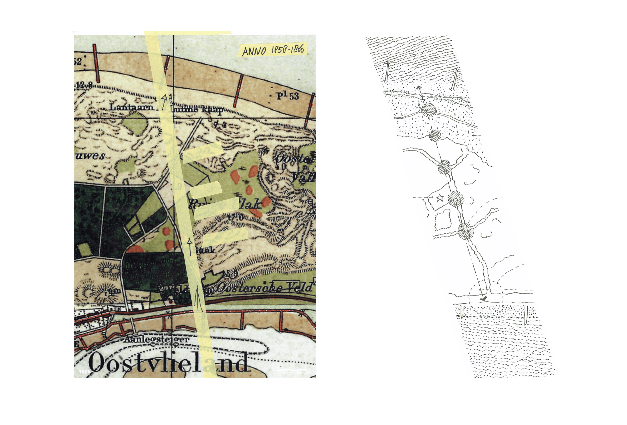
Interestingly, the Lutine Head has not been located at its original site since 1999, but 183 meters to the west. Yet many still consider this spot a familiar point of orientation, interwoven with their personal and collective memories of the island. What did the original, eastern head actually look like?
If the gold can no longer be found, what does the head still symbolize? From this fundamental question, the Lutinelijn has been developed as an exploratory art manifestation. Lutinelijn questions how we can look differently at the changing coastal landscape on Vlieland along former navigation lines. How can places along those lines provide us with points of orientation in the here and now? We reinterpret the Lutine gold as a symbol and pose the question: what does the gold form today?
Between mudflat and dune: in the lee of the season
In November 2024, the search for the Lutinelijn on Vlieland begins. While Sijas has been merged with the landscape for decades, Sjoerd is still exploring the edges of Vlieland.
Sjoerd
“The weather is gray. From Studio Betzy – the former artist’s studio home of Betzy Akersloot-Berg (1850 – 1922) – behind Museum Tromp’s Huys, I look out over the dike. The new dike body is there, waiting for grass sods. I recognize the pavement workers from the morning boat. Loaded with cool boxes, they got off the boat before me. The pavement workers are paving the new bike path at the foot of the dike. I wonder if my perspective from the studio has been taken into account in the development of the new dike profile. It wouldn’t have taken much for the mudflat to have disappeared from the studio behind the dike.”
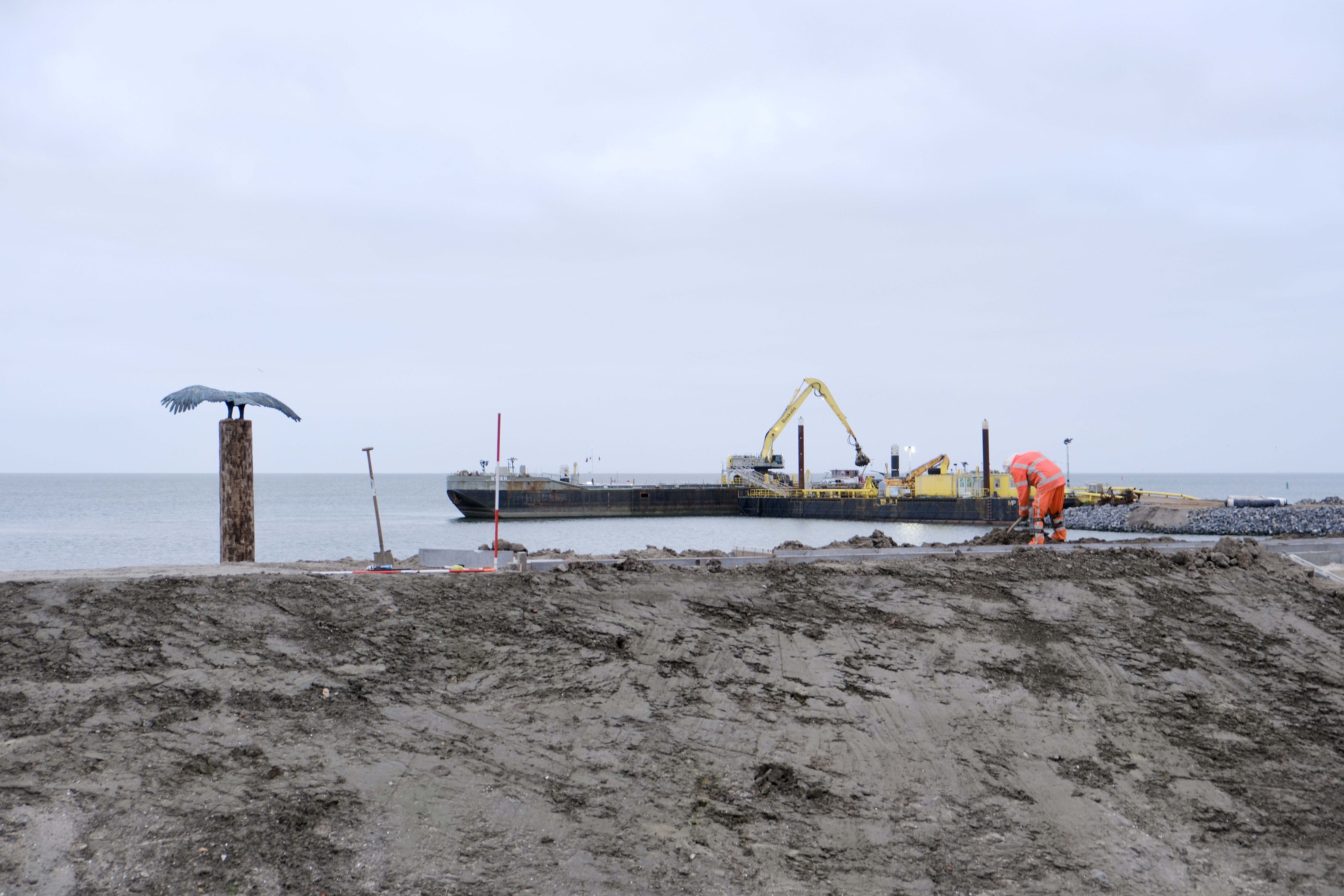
Photo: Sjoerd Willem Bosch and Sijas de Groot
In Tromp’s Huys, I look at the collection of old nautical charts full of buoyage and heads. Inspired, I wander that afternoon over a quiet island. At sea, beacons called out their presence: “Here I am!” But those beacons have almost all disappeared here, dissolved in the digital precision of GPS signals. What once was a visual anchor is now reduced to coordinates on a screen.
With Dirk Bruin, an islander and local historian, I search for the vanished Lutine Field Head. Dirk knows the story of the Lutine like no other. He tells me that he has photographed the foot of the field head before. After half an hour of searching at the spot, we finally discover a rusty steel foot between the rose hips. The coordinates don’t lie; with a floor-high marking, this spot was visible about ten kilometers to the north.
Sijas comes over for a day. From the terminal, where the ferry arrives, we first walk to the Lutine Field Head. I point the way and show him the steel foot.
We speak in:
“We have a first anchor point – here stood the Lutine Field Head. We don’t know when it was demolished. We think it was an iron structure. The pole was about ten meters high. That pole was also called the king. It had a marking on it: a triangle, its crown.”
From here we continue along the imaginary Lutinelijn. We walk through the forest towards the campsite. Workers are replacing the water line along the Kampweg. The island is quiet. At the campsite, the broken tent houses await the winter under green tarps. We walk further into the campsite, with Sijas leading the way — he has been coming to Vlieland for forty years. His regular spot at campsite Stortemelk, fifty meters from the sea, is officially in section ‘green’, but is called the ‘gold coast’. In the lee behind the dune, one can fall asleep to the sound of the North Sea. At the empty seasonal spot, we sit in the grass and listen to the sea.
Sijas
“Vlieland has had a deep meaning in my transition from child to adult. The island served as a backdrop for initiation rituals. For me, it symbolizes a place of transformation and self-discovery. It provided a refuge, where I could break free from my environment and beliefs, and reorder myself.”
Along maps and heads
In March, we return to Vlieland. With maps under our arms — partly historical, partly imagined — we follow the imaginary Lutinelijn. In the group accommodation De Nulck, the line crosses our room. From the window, we look out at the dune where the original Lutine Head presumably stood, 182 meters east of the current location. A small shift on paper, a world of difference in the landscape.
The campsite lies still and deserted. In the forest, we meet a visitor from Terschelling who spent summers on Vlieland as a child. Riding on the back of his uncle, the forest ranger, he explored the island. Now he returns, searching for the places of his youth. We ask him about the “Ruige Plak” — a place where plants are allowed to run wild, he says. On the map, we find another marking: “Baak”. A forgotten beacon? It must have stood high in the forest, but the deep pit brings us closer in thought to that vanished “Baak”.
Later, we meet Hans Stolk and Peter Schalk in Tromp’s Huys. Hans — grandson of Willem Duinker, founder of the large holiday home site Duinkersoord — recognizes the themes of heritage, tourism, and the island's rhythm in our story. He mentions the heads: Kaap Bol, the Strandkaap, the Grote Kaap and how they are connected with tourism. We talk about the repurposing of heads and the shifting meaning of Lutine gold.
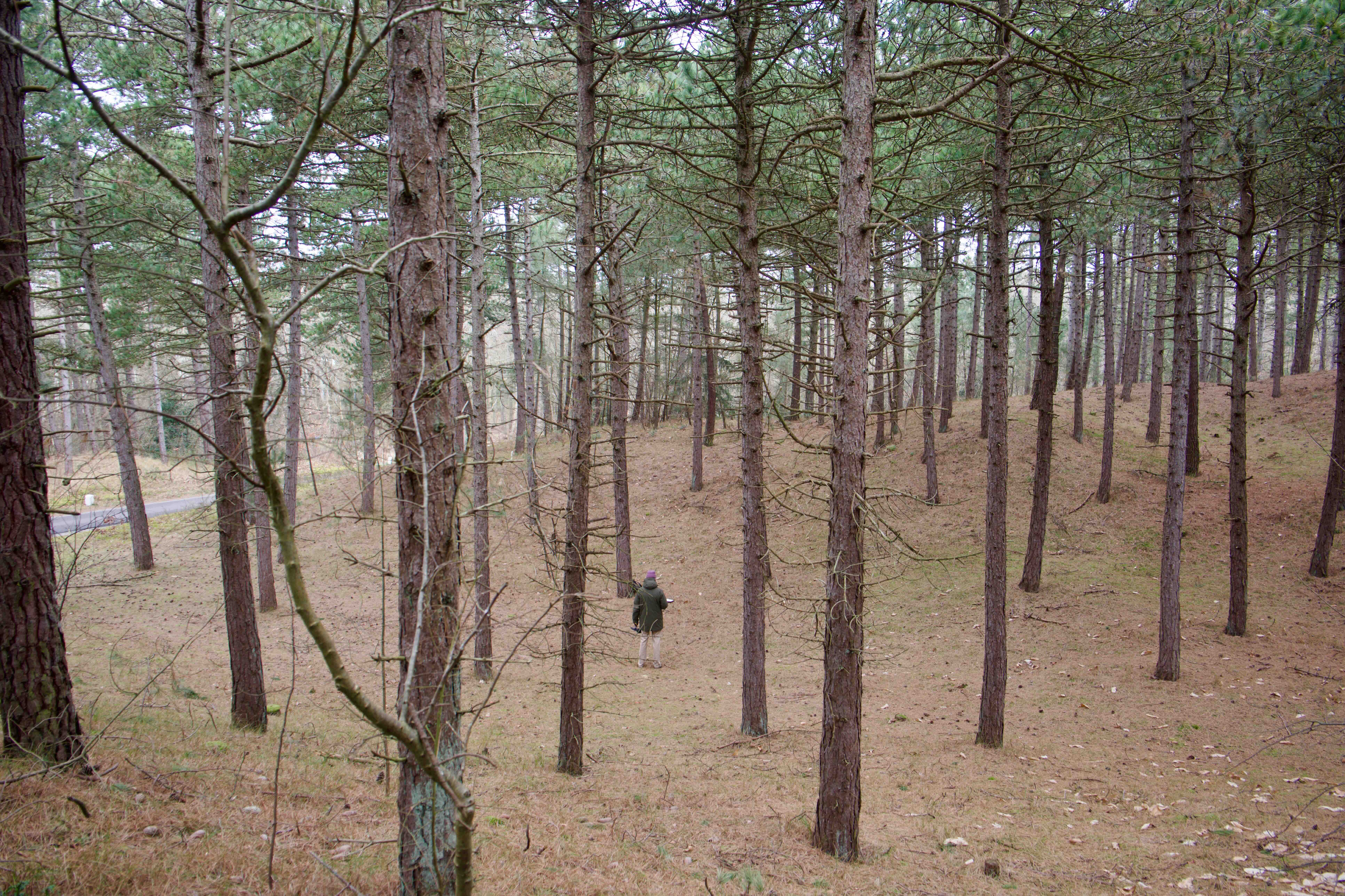
Photo: Sjoerd Willem Bosch and Sijas de Groot
We speak in:
“You could also give that look forward, of how can you rethink that gold story, that gold hunt, gold lust, to ask that more metaphysical question. Where does the gold lie for you? And perhaps simpler, why do you come here and what do you love? And how do you come home?”
The next day, we organize a walk along the Lutinelijn. We start at the mudflat, where we briefly tell something about our project and the vanished beacons on the island. The group consists of islanders and vacationers. Everyone gets a sheet of paper and writes down a word that sticks with them at that moment — something they see, feel, or think.
We walk into the forest. There, we pass the sheets of paper to one another. Sjoerd describes the landscape from over a hundred years ago: “Imagine an island without trees, just sand, air, and wind. How do you know where you are? Where do you want to go?”
Next to the word of their predecessor, they draw the landscape. Not realistically, more an impression of the former landscape. This creates a series of personal combinations of words and images, passed impressions to look at the landscape differently.
Four places – one line
In May, we see the island change. During Easter, Sijas set up the tents on their familiar seasonal spot with his sister and brother-in-law. Work is being done on new tent houses, seasonal workers come and go — the rhythm of arrival and departure is more visible than in winter.
With our growing archive, we engage in conversation with islanders, vacationers, and workers. What does the island mean? What is coming home? And what does the crossing — the boat as a time capsule — do to our perception of time and place? We register what we encounter. Ambient sound, the relief of the landscape, light, voices.
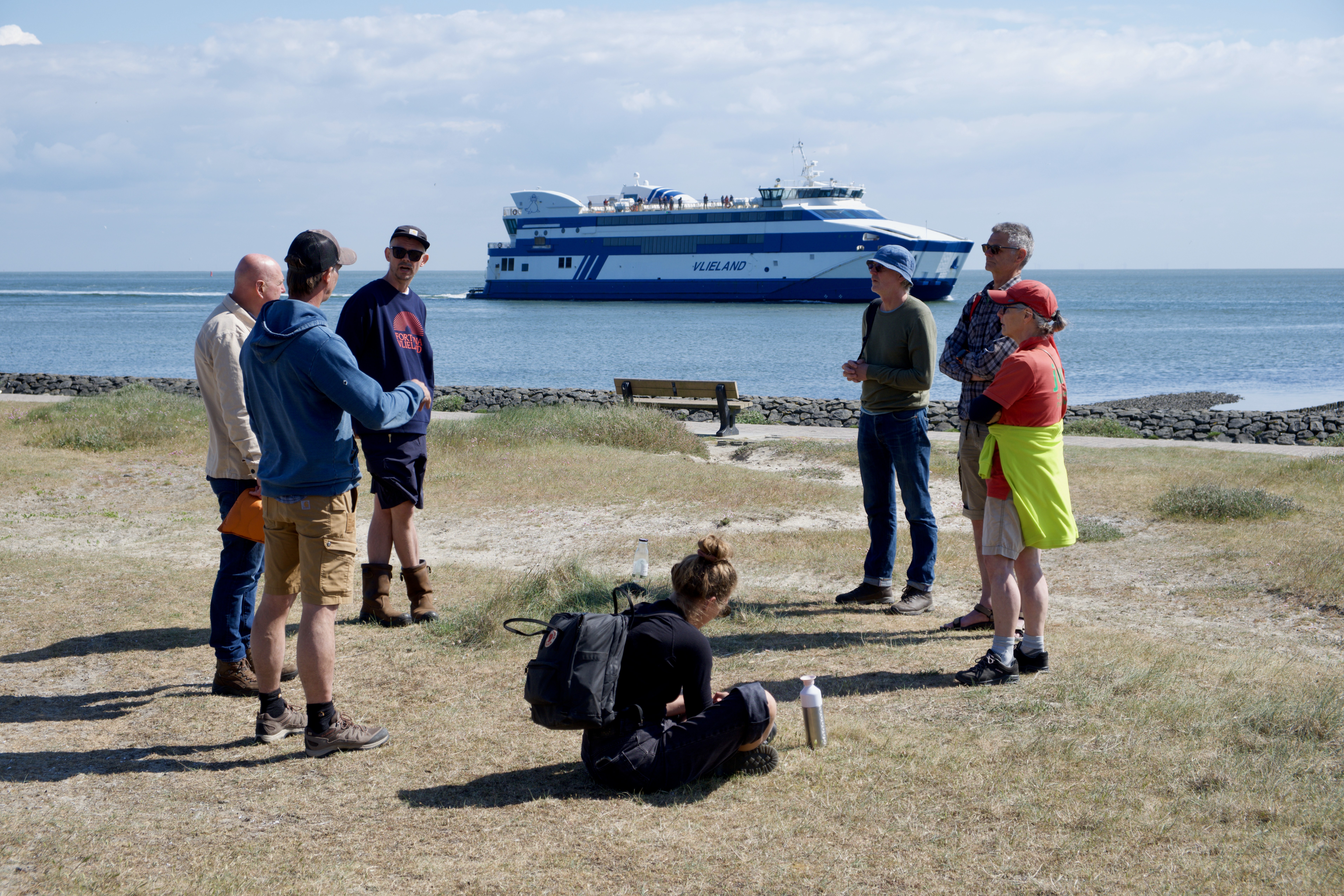
Photo: Sjoerd Willem Bosch and Sijas de Groot
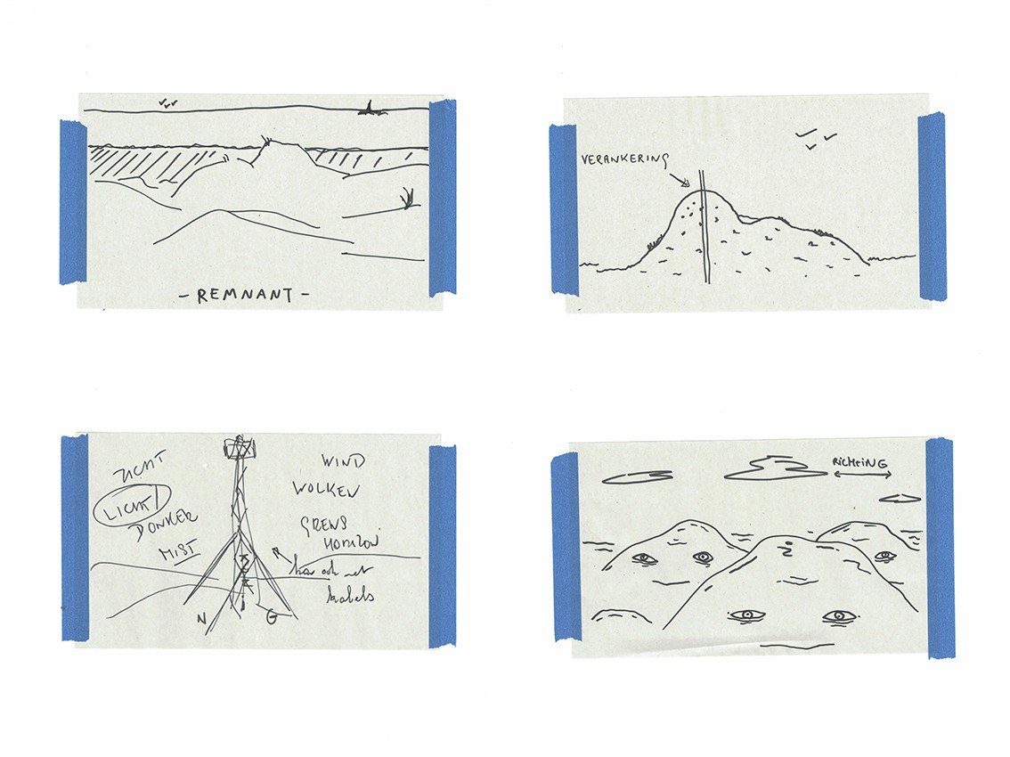
We select four places where the line seems tangible for us. Four anchor points, four ways to mark. At the mudflat, a place where we will temporarily set up a mobile beacon: as axis mundi. In the forest edge, the place of the remnant of the original Lutine Field Head: an anchor point. Further along in the forest, the pit, where an unclear beacon once stood: a place for suggestion. And in a dune bowl, next to the Lutine Head from 1999, a place that evokes wonder.
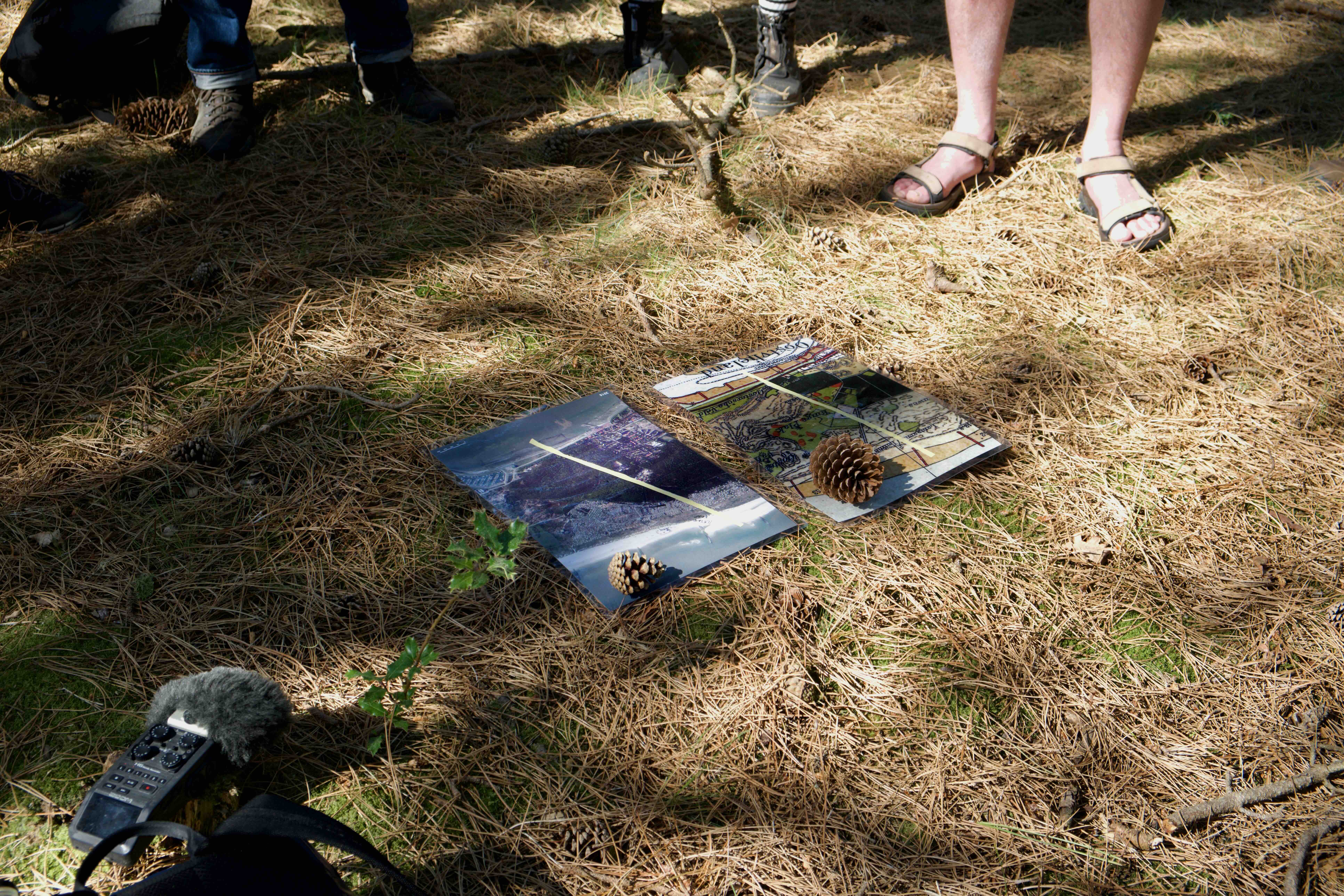
Photo: Sjoerd Willem Bosch and Sijas de Groot
Heritage as a living conversation with the island
We have touched the line, the island seemed to respond. In winter, Vlieland shows itself in a different form: quieter, rawer, and sometimes somewhat elusive. It is precisely in that interim period, where the island prepares for the season, that things stand out that might otherwise be overlooked. We notice how heritage here is not just a relic of the past, but something of the now: in how people relate to a place, and what they want to recognize in it time and time again.
The stories and memories gathered together form a rich tapestry of meaning and experience. They tell of yearning, rituals, and feelings of home on Vlieland, but also about leaving and carrying away the island in the mind. These stories guide our work and connect us with the place and its people. The four places we have chosen form a first structure of Lutinelijn. We see the places as open spaces, places where we can let work and stories land. The line becomes clear.
For the four places, we will work further on four stories and spatial interventions, bringing objects and landscape together. These places invite reflection: what can a beacon mean today? How do you mark something that seems elusive?
The island is the island and remains the island precisely because the island is where the island is.
[1] Knol, E. (2014, November 27). Small maritime heritage strengthens identity Wadden Sea. Friesch Dagblad. Consulted via: https://www.dekrantvantoen.nl/vw/article.do?code=FRD&date=20141118&v2=true&id=FRD-20141118-01024001
[2] De Telegraaf. (1933, May 12). Above the “Lutine” wreck. De Telegraaf. Consulted via https://resolver.kb.nl/resolve?urn=ddd:110569439:mpeg21:a0285
Sijas de Groot - tussenland.net - @sijaspaulus
Sjoerd Willem Bosch - sjoerdwillembosch.com - @sjoerdwillembosch
Tussenland - @tussenland


